
Taiwan defence think tank says a Chinese survey ship faked its position near the Bashi Channel
INDSR says the Jia Hai Ke 7, escorted by a Chinese coast guard ship, may have charted submarine routes and the location of cables and sensors.
TAIPEI —
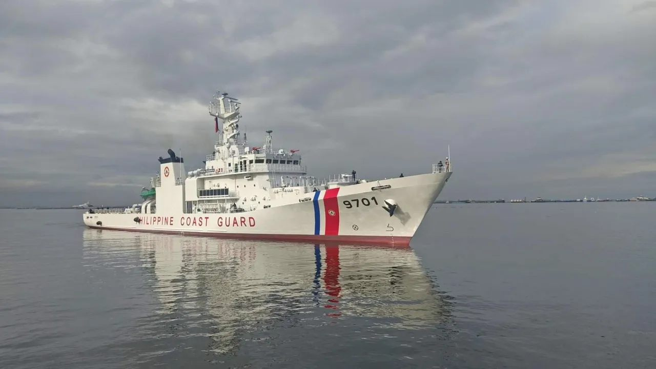
Taiwan's Institute for National Defense and Security Research (INDSR) said in an assessment published on Monday, 9 November, that a Chinese ocean survey ship broadcast false Automatic Identification System signals to hide its real track while it lingered near the Batanes islands in the northern Philippines. The institute also said a China Coast Guard ship accompanied the survey vessel during its stay.
According to the assessment, the 2,000-tonne Jia Hai Ke 7 belongs to Zhuhai Jiahai Marine Technology, a private Chinese company, and stayed around the Batanes from late September to early October. The institute argued that the coast guard escort showed the mission had an official or military purpose. It said ship-tracking data placed the survey ship and China Coast Guard vessel 14608 in the same waters at the same time.
The INDSR said the Philippine Coast Guard sent its patrol ship Teresa Magbanua to shadow the survey vessel, while Taiwan's Coast Guard Administration deployed ships to watch from the Taiwanese side of the area. The institute described this as each country separately keeping watch on Chinese grey-zone activity in sensitive waters where their interests overlap.
Manila made the episode public at the time. The Philippine Coast Guard said the ship was seen loitering north-west of Itbayat on 28 September and, on 1 October, sent the Teresa Magbanua and an Islander patrol aircraft to push it out of the Philippine exclusive economic zone. The Maritime Executive reported then that the Philippine ship closed to about 50 yards during that effort, and that the area carries telecommunications cables linking the Philippines with Taiwan.
The new assessment sets out why the institute thinks the location matters. It said the sea between the Bashi Channel and the Batanes is between 2,000 and 5,000 metres deep and links the South China Sea with the western Pacific. In the institute's view, it is a key route for Chinese submarines moving through the first island chain and, in wartime, for any attempt to blockade the port of Kaohsiung and the waters off eastern Taiwan.
The INDSR said the ship carries a DP-2 dynamic positioning system and a multibeam echo sounder, which allow it to hold its position in strong currents and survey the seabed and water layers in detail. The institute assessed that such data, once added to Chinese military databases, could help submarines understand how sound travels underwater and where sonar blind spots lie, so that they can plan routes that avoid anti-submarine detection.
The assessment also pointed to several undersea communication cables in the area and to fixed underwater listening arrays that it said the United States and its allies have long relied on to track Chinese submarines. It argued that long stays at fixed points could help the survey ship work out cable routes and the location of any listening equipment, which could then be targeted or bypassed in a conflict. The institute noted that parts of its analysis drew on restricted government information that it disclosed only in summary form.
The institute placed the episode after visits by the Chinese survey ships Xiang Yang Hong 22 and Xiang Yang Hong 03 to waters east of Taiwan in June and August this year. It called the survey ship's operation alongside a coast guard vessel further evidence of grey-zone pressure that warrants continued monitoring. The INDSR stated that the paper reflects the author's views rather than an official position of the institute.
Sources
More in Cross-Strait

China shows the GJ-11 stealth drone's internal weapon bay in new state TV footage
CCTV aired close-up video of the GJ-11, now codenamed Xuanlong, ahead of the PLA Air Force anniversary, giving a first view of its belly weapon bay.
TaiwanDefence · 2h ago · 3 min read
Four Chinese generals and admirals quit the national legislature as the military delegation keeps shrinking
Zhang Gong, Guo Jianjun, Wu Yuhong and Meng Qingbin resigned as NPC deputies with no reason given, taking military departures this term to 50.
TaiwanDefence · 3h ago · 3 min read
Chinese coast guard flotilla makes a sixth Kinmen incursion in two weeks despite heavy seas
Four China Coast Guard ships, the same hulls seen on 4 and 6 November, spent two hours in Kinmen's restricted waters as Taiwan called the move irrational.
TaiwanDefence · 6h ago · 3 min read
Discussion (0)
Comments are not currently available.